


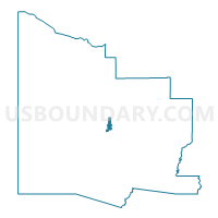
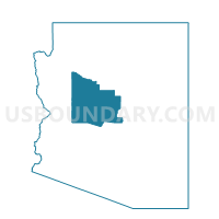
Yavapai Hills Voting District, Yavapai County, Arizona
About
Outline

Summary
| Unique Area Identifier | 525738 |
| Name | Yavapai Hills Voting District |
| County | Yavapai County |
| State | Arizona |
| Area (square miles) | 11.92 |
| Land Area (square miles) | 11.90 |
| Water Area (square miles) | 0.01 |
| % of Land Area | 99.90 |
| % of Water Area | 0.10 |
| Latitude of the Internal Point | 34.57985650 |
| Longtitude of the Internal Point | -112.39892260 |
Maps

Graphs
Select a template below for downloading or customizing gragh for Yavapai Hills Voting District, Yavapai County, Arizona


Neighbors
Neighoring Voting District (by Name) Neighboring Voting District on the Map
- Antelope Voting District, Yavapai County, AZ
- Deep Well Voting District, Yavapai County, AZ
- Diamond Valley Voting District, Yavapai County, AZ
- Holiday Voting District, Yavapai County, AZ
- Lynx Creek Voting District, Yavapai County, AZ
Top 10 Neighboring County Subdivision (by Population) Neighboring County Subdivision on the Map
Top 10 Neighboring Place (by Population) Neighboring Place on the Map
Top 10 Neighboring Unified School District (by Population) Neighboring Unified School District on the Map
Top 10 Neighboring State Legislative District Lower Chamber (by Population) Neighboring State Legislative District Lower Chamber on the Map
Top 10 Neighboring State Legislative District Upper Chamber (by Population) Neighboring State Legislative District Upper Chamber on the Map
Top 10 Neighboring 111th Congressional District (by Population) Neighboring 111th Congressional District on the Map
Top 10 Neighboring Census Tract (by Population) Neighboring Census Tract on the Map
- Census Tract 19, Yavapai County, AZ (14,010)
- Census Tract 3, Yavapai County, AZ (5,207)
- Census Tract 5, Yavapai County, AZ (4,719)
- Census Tract 7, Yavapai County, AZ (3,972)
- Census Tract 8.02, Yavapai County, AZ (3,308)